
Tongariro Alpine Crossing – New Zealand’s Great Day Walk
The Tongariro Alpine Crossing is New Zealand's greatest day walk - 19.4km across an active volcano. Our honest guide to the route, shuttles, weather and packing.
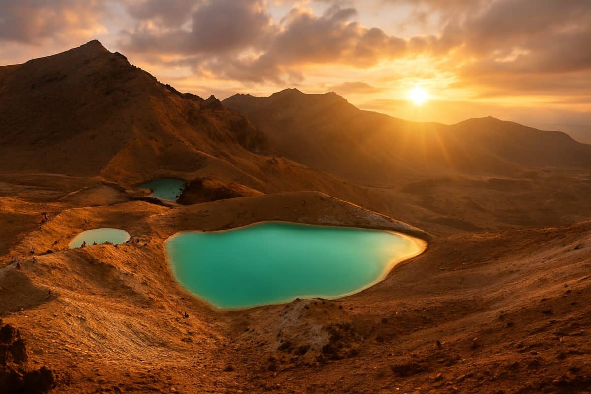
The first time we stood at the lip of Red Crater, nobody in the group said anything for a while. Below us the Emerald Lakes burned green against black volcanic rock, the wind was trying to take our hats to Taupo, and the whole improbable moonscape just kept going. The Tongariro Alpine Crossing is the walk every visitor to New Zealand hears about, and for once the hype is earned — ming fu qi shi (名副其实), it lives up to its name — but it is also a serious alpine day that catches unprepared people out every single season. Here is what it is actually like, and how to do it well.
New Zealand’s Greatest Day Walk | 新西兰最棒的一日徒步
What the Crossing Actually Is | 这条步道到底是什么
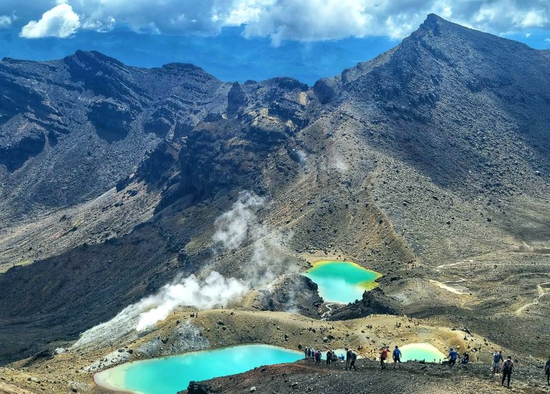
Let us be honest about what you are signing up for. The Tongariro Alpine Crossing is a 19.4 km one-way walk (recently remeasured to 20.2 km after track changes) over an active volcanic landscape in the central North Island, and it is routinely called the best single-day hike in New Zealand. We have walked it three times now, and the description we keep coming back to is bie you dong tian (别有洞天) — a world utterly apart. You start in tussock at 1,120 m, climb to the Red Crater at 1,886 m, and descend to 760 m at the far end. It takes most people six to eight hours in summer. It is not a stroll (bu shi san bu, 不是散步), and the people who treat it like one are the people the rescue helicopters know by name.
A Sacred Maunga, Not a Theme Park | 神圣的圣山,而非游乐场
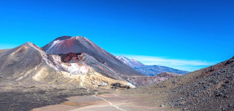
The Crossing sits inside Tongariro National Park — New Zealand’s oldest park and a dual UNESCO World Heritage site, recognised for both its volcanic landforms and its Maori cultural significance. To many Chinese visitors this is a sheng shan (圣山) — a sacred mountain — and that is exactly right: the peaks here are ancestors to Ngati Tuwharetoa and Ngati Hikairo ki Tongariro, who are the kaitiaki (guardians) of the maunga. After fires burned part of the area in 2025, the hapu placed a ten-year restorative rahui over the affected land; you walk through it, so stay on the track and clean your boots. Film fans will recognise the perfect cone of Ngauruhoe as Mount Doom, though climbing it is no longer permitted at the iwi’s request. Treat the place as what it is: sacred ground that happens to be spectacular.
The Route, Crater by Crater | 一个火山口接一个火山口
The Devil’s Staircase | 魔鬼阶梯
The first 5.4 km from Mangatepopo are deceptively gentle — boardwalk through scrubland, a shared section with the easy Soda Springs walk, the kind of start that lulls you. Then comes the Devil’s Staircase (mo gui jie ti, 魔鬼阶梯), a steady 350 m climb up to South Crater that sorts the prepared from the optimistic. Take it slow. South Crater itself is a flat, steaming moonscape ringed by peaks; on a clear morning it is the most other-planetary place most visitors will ever stand. On a bad one you will not see the far side. Either way, this is the halfway psychological marker — the climbing is mostly behind you once you crest the next ridge.
Red Crater and the Emerald Lakes | 红火山口与翡翠湖
The push to Red Crater (1,886 m, the high point) is the steepest, most exposed stretch, often in wind that arrives from nowhere. The reward is immediate: the Emerald Lakes — Nga Rotopounamu, the fei cui hu (翡翠湖) you have seen in every photo — glowing impossible green below you, coloured by dissolved minerals. The descent to them is loose volcanic scree, and it is where most slips happen; we have watched confident hikers go down hard here. Short steps, low centre of gravity, no hurry (man man zou, 慢慢走). Past the lakes you skirt Blue Lake (Te Wai Whakaata o Te Rangihiroa, Rangihiroa’s mirror), a tapu lake you do not touch or eat beside. This is the stretch the photographs are made of, and it earns it.
The Long Descent | 漫长的下山路
Nobody warns you enough about the last two hours. From Ketetahi the track zig-zags down the northern flank for what feels like forever — endless steps, easy on the lungs and brutal on tired knees. There is a wry phrase for exactly this stretch: xia shan bi shang shan nan (下山比上山难) — coming down is harder than going up. The views over Lake Rotoaira and the great expanse of Lake Taupo are genuine compensation, and the vegetation thickens back into bush near the end. Walking poles, which felt like overkill at the car park, become your best friends here. The track finishes at Ketetahi Road; the car park gate closes at 7 pm, so there is no need to sprint, but do not dawdle so long on the Emerald Lakes that you are descending in the dark.
Getting There: Shuttles and Booking | 如何抵达:接驳车与预订
Why You Cannot Just Drive and Park | 为什么不能自驾停车
Because the Crossing is one-way, your car cannot wait for you at the finish, and in summer there is no visitor parking at the Mangatepopo start at all. Everyone uses a shuttle (jie bo che, 接驳车). Operators run from Turangi, National Park village, Taupo, Ohakune and Taumarunui, typically dropping you at the start before dawn and collecting you from Ketetahi in the afternoon; a round-trip transfer from Turangi runs around NZ$80. Book it before you book anything else, because the shuttle slot effectively sets your walking day. Full transport details and operator contacts are on the official Tongariro Alpine Crossing site. Do not, as the signs beg, park on the side of State Highway 46 or 47.
The Booking System | 预订系统
Since late 2023, the Department of Conservation has run a free booking system (mian fei yu ding, 免费预订) for the track — you reserve a time slot for any part of the Crossing, and you need a booking to use a shuttle or guided service. It costs nothing, it takes two minutes, and it exists so DOC can manage numbers and, frankly, find you if something goes wrong. Sort it through the DOC track page along with the current weather and volcanic-status notices. In peak summer the popular slots and shuttles do sell out, so this is not a same-morning decision — lock it in a week or two ahead.
The Honest Bit: Fitness, Weather and Safety | 实话实说:体能、天气与安全
How Hard It Really Is | 到底有多难
DOC rates the fitness required as high, and they are right. You are walking 19-20 km, climbing around 800 m, crossing loose scoria and a steep descent, carrying maybe 5 kg of food, water and clothing, for the better part of a working day. Thousands of ordinary people finish it every summer — but they finish it because they trained, not because they are athletes. If your idea of exercise is the walk from the car park to the office, do a couple of loaded practice hikes with hills first. There is a saying that fits this walk exactly: lei, dan zhide (累,但值得) — exhausting, but worth it. Both halves of that are true.
Alpine Weather Catches People Out | 高山天气最容易让人措手不及
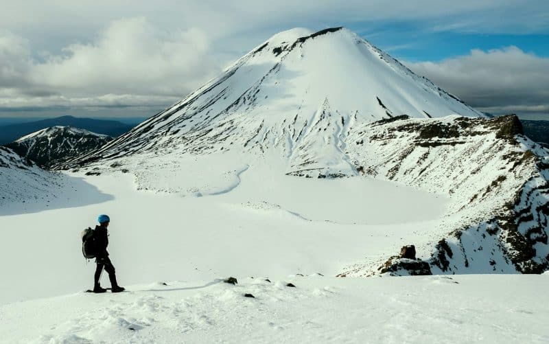
The name gained the word ‘Alpine’ in 2007 specifically to scare under-prepared walkers, because this track logs the highest number of search-and-rescue callouts in the country. The terrain is exposed volcanic rock with no shelter and no drinkable water, at altitude, where it can be sunny at the car park and a whiteout at Red Crater an hour later. Snow can fall any month of the year. Checking the forecast here is not the usual box-ticking advice — it is sheng si you guan (生死攸关), a matter of life and death. If the mountain forecast is bad, the walk will still be there next year. Turning back is not failure; it is the experienced move.
When to Go and What to Pack | 何时去、带什么
Summer Walker, Winter Mountaineer | 夏天是徒步,冬天是登山
From roughly November to April the Crossing is a hard but achievable walk for fit, prepared people doing it independently. From May to late October it becomes a different animal entirely — snow, ice, avalanche terrain and sub-zero wind chill mean you need genuine alpine skills, an ice axe and crampons, or, far more sensibly, a guide. The principle is liang li er xing (量力而行) — match your ambition to your ability. We cannot stress this enough: the summer track and the winter track share a map and nothing else. If you are visiting in the cold months and you are not a mountaineer, book a guided trip or choose a lower walk like Taranaki Falls instead. There is no shame in matching your ambition to your skills.
The Packing List That Matters | 真正重要的装备清单
Layers, always — the Chinese call it yang cong shi chuan yi (洋葱式穿衣), dressing like an onion — a warm top and a genuine windproof/waterproof shell even on a blue-sky morning, because the summit does not care about the forecast you saw at breakfast. Sturdy hiking boots with grip for the scree; trainers are how ankles get sprained. At least two litres of water (none of the springs up there are safe to drink), plenty of snacks and a real lunch, sunblock and a hat for the brutal alpine sun, and a basic first-aid kit. A phone for photos and emergencies, charged. Start early — most shuttles have you walking by 6.30 am — and you will be off the mountain with daylight and stories to spare.
Done properly — shuttle booked, weather checked, layers packed, knees braced for that descent — the Tongariro Alpine Crossing is one of those days you measure other travel against afterwards. Done carelessly it is the reason the rescue statistics look the way they do. Respect the maunga, match the season to your skills, start early, and give yourself permission to turn back if the mountain says no — liu de qing shan zai, bu pa mei chai shao (留得青山在,不怕没柴烧), the hills will still be here next year. Do that, and you will come down the northern slopes tired, wind-burnt, and quietly certain you have just walked through somewhere that should not exist.
5 Comments
That silence at Red Crater is real – we had the same thing. One warning for first-timers: the Devil’s Staircase is not the hard part, the loose scree down from Red Crater is what gets people. Poles helped me a lot.
Book the shuttle the night before in peak season or you will be stuck. We left Mangatepopo at 7am and beat most of the crowd to the lakes, which made all the difference for photos.
We attempted it in early October and turned back at the saddle because the wind was insane – exactly the call you say to make. Came back in February and it was a totally different, glorious walk. Respect the weather.
Seven and a half hours for us including a long lunch at the lakes. People underestimate how long the descent to Ketetahi drags on. Take more water than you think.
Good of you to mention the rahui and treating the maunga with respect – a lot of guides skip that. It matters. Ka pai.