
Keeping Up with New Zealand: Seasonal Travel News and Updates
Where to check NZ road closures, DOC track alerts, ferry status and weather warnings. Practical sources from people who drive this country year-round.
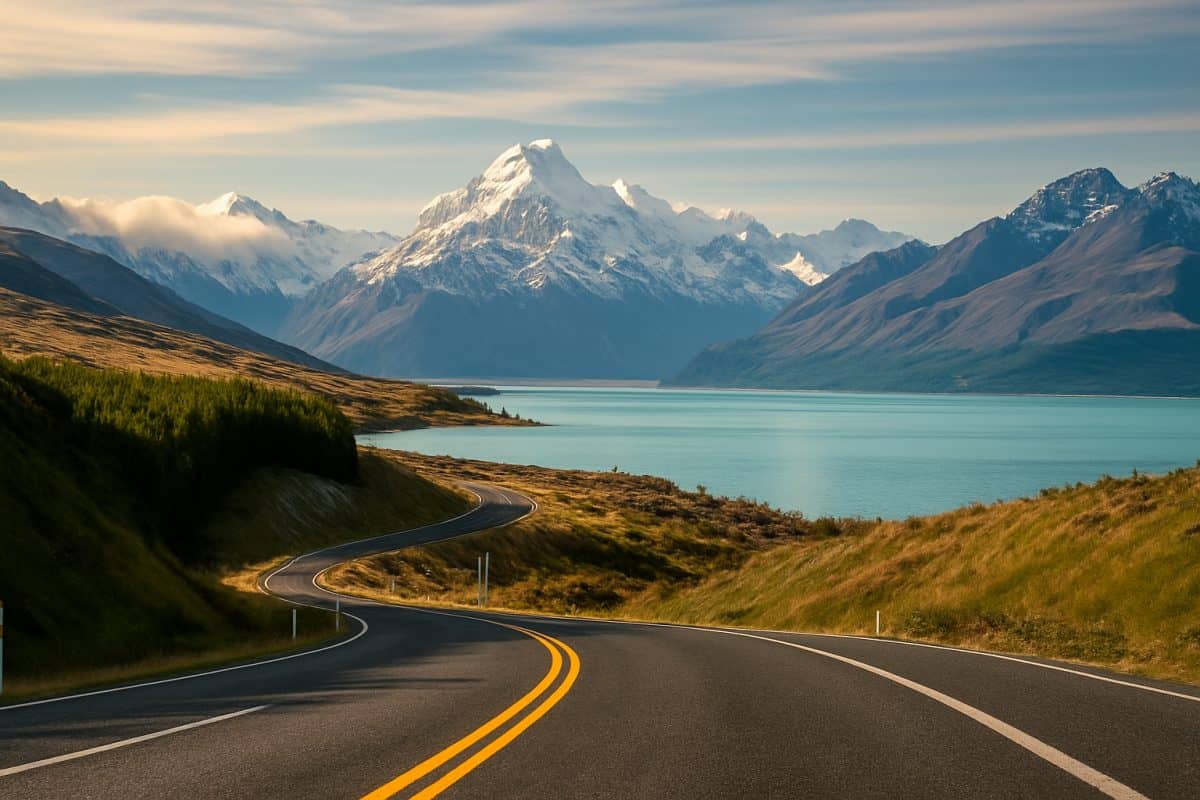
We have been caught out by every one of the things this article covers — closed roads, cancelled ferries, locked DOC huts, alpine weather that arrived three hours ahead of the forecast. After a decade of travelling New Zealand, the lesson that took longest to learn was not where to go but how to check whether you actually can. This country runs on seasons, weather systems, and a transport network that bends to both, and staying informed is not optional if you want your trip to work.
Roads Close Here Without Much Warning
The NZTA Journey Planner and What It Actually Tells You
We learned about NZTA the hard way — driving south through Canterbury in July, following Google Maps towards Tekapo, and finding a barrier across the road with a handwritten sign that said “Closed until further notice.” Nobody had emailed us. Nobody had sent a push notification. The Lindis Pass was shut by snow, and the detour added three hours to our day.
The NZTA Journey Planner is the single most important bookmark for anyone driving in New Zealand. It shows real-time conditions across every state highway in the country — closures, delays, roadworks, chain requirements, and estimated reopening times. The interface is not beautiful, but the information is current and it covers things that Google Maps simply does not know about. State Highway 94 to Milford Sound closes for avalanche risk multiple times each winter. The road over Arthurs Pass can shut for slips after heavy rain in any season. The Rimutaka Hill Road between Wellington and the Wairarapa gets ice warnings that do not make it onto any navigation app.
If you grew up in China, where highways between major cities are engineered for year-round operation, the frequency of weather closures in New Zealand takes adjustment. This is a country where a single-lane bridge and a flooded creek can cut a state highway for hours. Checking NZTA before you leave is not caution — it is basic trip planning.
Snow Chains and Alpine Passes
Winter driving in the South Island introduces a problem that most visitors from East Asia have never encountered: mandatory snow chains. Several alpine passes require chains to be fitted when conditions deteriorate, and police will turn you around if you do not have them.
The Crown Range Road between Queenstown and Wanaka is the most common surprise. It is a beautiful, steep road that looks perfectly manageable on a summer visit, and then becomes a chain-mandatory alpine pass in June. The Lindis Pass, Arthurs Pass, Lewis Pass, and Porters Pass all carry chain requirements at various points through winter. The NZTA journey planner flags these in real time, and the requirement can change within hours as weather shifts.
Here is the practical problem: most rental car companies in New Zealand do not permit chains on their vehicles. Read your rental agreement before you drive into the mountains in winter. Some specialist rental operators cater to ski traffic and supply chains, but the major companies at the airport generally do not. You can buy chains from automotive stores in Queenstown, Christchurch, or Wanaka, but fitting them for the first time in a snowstorm on the side of the Crown Range is an experience we would not recommend to anyone. If you are planning a winter South Island trip, sort out the chain question before you leave your accommodation — not at the top of the pass.
Regional Council Road Pages Worth Bookmarking
The national highway network is only half the picture. Once you leave the state highways, road management falls to regional and district councils, and their information systems vary wildly in quality.
Canterbury has a decent journey planner that covers local roads, which matters if you are trying to reach places like Akaroa or the Mackenzie Country via back roads. The Otago Regional Council publishes road condition updates that are useful for anyone exploring the hinterland around Dunedin or Central Otago. Waikato roads are generally well-maintained but flood-prone in winter — the council website flags closures when the Waikato River system does what it does every few years.
The honest truth is that council Facebook pages are often updated faster than the official websites. We have lost count of the number of times a road was clearly closed but the council journey planner still showed it as open, while the council Facebook page had a post from two hours ago with a photo of the slip. It is not the system you would design from scratch, but it is the system that exists. If you are heading into rural New Zealand on secondary roads, check the relevant council social media before you leave. A five-minute scroll can save you a two-hour dead end.
Tracks Open and Tracks Closed — DOC Is Your First Call
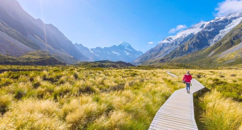
The DOC Alerts System and How to Read It
The Department of Conservation manages over a third of New Zealand — every national park, most tramping tracks, hundreds of huts and campsites, and a significant chunk of the coastline. When something changes on public conservation land, DOC is the source.
The DOC website has an alerts system that shows current conditions for specific places. You search by track name, park name, or region, and the alerts page shows closures, maintenance, predator control operations (which sometimes restrict access), and warnings. The system is straightforward once you understand how it is organised: information lives on the page for the specific track or hut, not on a central dashboard. If you want to know whether the Routeburn Track is open, you go to the Routeburn Track page and check the alerts tab.
The Great Walks pages are reliably up to date — DOC puts serious resource into maintaining those. Smaller tracks are less consistently updated, and we have occasionally arrived at a trailhead to find a sign about a washout that was not mentioned online. For any track you care about, you can sign up for email alerts through the DOC website. We have alerts set for about fifteen tracks across the South Island, and the emails have saved us wasted drives more than once.
Seasonal Closures That Catch People Out
Some of the most popular outdoor experiences in New Zealand have hard seasonal closures, and they are not always obvious until you are already committed to your itinerary.
The Great Walks operate on a booking season that roughly spans October to April, depending on the track. Outside those dates, huts revert to first-come-first-served backcountry status, some facilities shut down, and conditions can be genuinely hazardous. The Milford Track closes entirely from May to late October. The Tongariro Alpine Crossing remains technically open in winter, but requires alpine experience, crampons, and ice axes — it is not the same walk that 130,000 people do in shorts and sneakers each summer.
For anyone arriving from China, where major scenic spots and national parks operate year-round with managed infrastructure, the concept of a world-famous walk simply shutting for half the year takes some getting used to. We had a group of friends visit from Shanghai one August who wanted to walk the Tongariro Crossing. We had to explain that the walk they had seen on Xiaohongshu — the one with the emerald lakes and clear skies — only exists from late November to March, and that the winter version is a serious mountaineering proposition. They went to Hobbiton instead, which is open every day of the year.
Checking Conditions Before You Lace Up
Before any tramping trip in New Zealand, we run through the same routine. It takes about ten minutes and it has kept us out of trouble more times than we can count.
First, check the DOC alerts page for the specific track. Second, check the MetService mountain forecast for the region — not the city forecast, which might show fine weather while the ranges are getting hammered. Third, if the online information looks stale or ambiguous, call the local DOC office. This sounds old-fashioned, but DOC staff are remarkably helpful and they know their patch. They will tell you if the track is muddy, if there has been a recent slip, if the river crossings are up, and whether anyone else has gone in that day.
The New Zealand Mountain Safety Council also publishes useful condition reports and safety guidance, particularly for routes that cross alpine terrain. Their trip planning tools are worth bookmarking. The core principle is simple: conditions in New Zealand mountains change faster than the websites update. A forecast that showed settled weather at 8am can mean a front arriving by 2pm. We check conditions on the morning of the walk, not two days before, and we have turned around at the carpark more than once when the information did not match our skill level.
Weather Shapes Everything Here
MetService and When to Trust It
MetService is the official weather forecasting service for New Zealand, and for travellers it is the single most important source of information after NZTA. The website and app provide standard city forecasts, but the products that matter most for travel planning are the severe weather warnings, the mountain forecasts, and the rain radar.
Severe weather warnings are issued for heavy rain, strong wind, heavy snow, and storm surges. They cover specific regions and time periods, and they are the clearest signal that your plans need adjusting. If MetService issues an orange or red warning for the region you are heading to, reschedule. This is not overcaution — New Zealand weather systems can be violent, and the infrastructure is not built to operate through them.
The mountain forecasts are essential for anyone heading into the hills. City forecasts for Queenstown might show 15 degrees and partly cloudy, while the mountain forecast for the Remarkables shows wind gusts of 120 kilometres per hour and zero visibility above the bushline. These are different weather systems, and treating the valley forecast as representative of the mountains is how people get into trouble.
One thing that surprises most newcomers: NZ weather forecasts become unreliable beyond about three days, and in some regions — the West Coast, Cook Strait, the Southern Alps — even two days is optimistic. Plan with flexibility.
The Seasonal Calendar That Travellers Need
New Zealand has four distinct travel seasons, and understanding them is the difference between a trip that flows and one that fights the calendar.
Summer runs from December to February and is peak season. The weather is warmest, the days are longest, and nearly everything is open. It is also when every other person in the country is on the road. The two-week period around Christmas and New Year is the single busiest travel window — accommodation in popular areas books out months ahead and prices can double. For Chinese New Zealanders, this period often overlaps with family visits and annual leave, which makes early booking essential. Chinese New Year, which falls in January or February, adds another domestic travel peak as families take advantage of the holiday to explore.
Autumn, from March to May, is when we personally prefer to travel. The crowds thin dramatically after Easter, the weather in most regions is settled and warm, and the changing colours in Central Otago and the Waikato are worth driving for. Many operators drop their prices.
Winter from June to August restricts access in the South Island mountains but opens ski season and makes the hot pools genuinely appealing. Spring from September to November is the most unpredictable — you can get four seasons in a single drive from Christchurch to Hanmer Springs — but the lambing paddocks and kowhai flowers make it beautiful. School holidays in April, July, and October create mini-peaks that are worth knowing about when you book.
Ferries, Flights and the Art of Plan B
Cook Strait Ferry Status — Check Before You Drive to the Terminal
Cook Strait sits between the North and South Islands, and the ferries that cross it are the single biggest variable in any inter-island road trip. The strait is one of the most unpredictable waterways in the world, and cancellations happen regularly — not just in winter storms but in the sudden swells and northwesterly gales that can arrive in any month.
Both operators — Interislander and Bluebridge — publish service status on their websites and social media. Check these on the morning of your crossing, not the night before. We have seen calm forecasts turn into cancellations by dawn. When sailings cancel, they often cascade: one missed sailing pushes passengers onto the next, which overflows onto the one after that. A single bad day on Cook Strait can disrupt ferry schedules for 48 hours.
The practical consequence is real. If you are driving from Wellington to Christchurch and your ferry cancels, you are stuck in Wellington with a car and a motel booking 500 kilometres away. We know families who have spent unplanned nights sleeping in their cars at the Picton terminal waiting for the next available sailing. This is not hypothetical — it happens multiple times every winter and occasionally in summer when a strong front pushes through.
Building Flexibility Into Your Itinerary
The most important piece of NZ travel advice we can offer has nothing to do with any website or app: build slack into your plans.
If your itinerary crosses Cook Strait, do not book the ferry for the same day as a flight, a hotel check-in with a strict arrival window, or anything else that cannot move. We schedule our ferry crossings with a full buffer day on either side — if the sailing goes ahead, we get an unexpected free day in Picton or Wellington, which is never a hardship. If it cancels, we have room to rebook without everything downstream collapsing.
The same logic applies to any day that involves alpine passes, mountain weather, or long rural drives. The Chinese travel planning instinct — wan mei piao, everything scheduled, every hour accounted for — is a strength in countries with predictable infrastructure. In New Zealand, it becomes a vulnerability. The weather does not care about your itinerary. A slip on the Haast Pass does not check your booking confirmation.
We have learned, over a decade of driving this country, to treat our plans as intentions rather than commitments. The best days we have had in New Zealand were often the ones where the original plan fell apart and we ended up somewhere unexpected — a hot pool we did not know existed, a coastal walk that a DOC ranger suggested when we called about a closed track, a pub in a town we had never heard of. Flexibility is not a compromise in New Zealand. It is how you actually travel here.
None of this information is hard to find — it just needs to be found before you leave, not at a road barrier or a closed trailhead. The websites and phone numbers mentioned here are the same ones we check every time we plan a trip, and they have not changed much in ten years. What has changed is our attitude: we used to see cancellations and closures as the trip going wrong. Now we see them as the trip being honest about what kind of country this is.